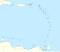
Файл:Lesser Antilles location map.svg
Уҡыу көйләүҙәре

SVG сығанаҡ файлы өсөн PNG ҡарап сығыу ваҡытындағы күләме: 698 × 599 пиксель. Башҡа айырыусанлыҡтар: 280 × 240 пиксель | 559 × 480 пиксель | 894 × 768 пиксель | 1192 × 1024 пиксель | 2385 × 2048 пиксель | 1346 × 1156 пиксель.
Сығанаҡ файл (SVG файлы, кәмендә 1346 × 1156 нөктә, файлдың дәүмәле: 184 КБ)
Файл тарихы
Файлдың күрһәтелгән ваҡытта ниндәй өлгөлә булғанын ҡарар өсөн баҫығыҙ: Дата/ваҡыт
| Дата/ваҡыт | Миниатюра | Үлсәмдәре | Ҡатнашыусы | Иҫкәрмә | |
|---|---|---|---|---|---|
| ағымдағы | 13:59, 24 сентябрь 2018 |  | 1346 × 1156 (184 КБ) | NordNordWest | Reverted to version as of 14:01, 13 October 2010 (UTC); please don't change the size of the map, some templates need the correct size |
| 12:00, 24 сентябрь 2018 |  | 512 × 439 (114 КБ) | Splintax | Nations grouped together and labelled with DOM IDs and inline styles replaced with semantic CSS classes. This reduces the file size and allows the SVG to be animated with JavaScript (eg. to selectively add labels, or change the style of a particular country to highlight it). | |
| 14:01, 13 октябрь 2010 |  | 1346 × 1156 (184 КБ) | NordNordWest | upd | |
| 15:56, 29 сентябрь 2009 |  | 1346 × 1156 (281 КБ) | NordNordWest | =={{int:filedesc}}== {{Information |Description= {{de|Positionskarte der Kleinen Antillen}} Quadratische Plattkarte, N-S-Streckung 103 %. Geographische Begrenzung der Karte: * N: 19.2° N * S: 9.7° N * W: 70.5° W * O: 59.1° W {{ |
Файл ҡулланыу
Был файлды киләһе бит ҡуллана:
Файлды глобаль ҡулланыу
Был файл түбәндәге википроекттарҙа ҡулланыла:
- af.wikipedia.org проектында ҡулланыу
- als.wikipedia.org проектында ҡулланыу
- ar.wikipedia.org проектында ҡулланыу
- az.wikipedia.org проектында ҡулланыу
- be.wikipedia.org проектында ҡулланыу
- bs.wikipedia.org проектында ҡулланыу
- ceb.wikipedia.org проектында ҡулланыу
- ckb.wikipedia.org проектында ҡулланыу
- cs.wikipedia.org проектында ҡулланыу
- da.wikipedia.org проектында ҡулланыу
- de.wikipedia.org проектында ҡулланыу
- Liste der Nationalparks im Königreich der Niederlande
- Oranjestad (Sint Eustatius)
- Benutzer:Spischot/Sketchpad 3
- Cricket World Cup 2007
- Flamingo International Airport
- Kralendijk
- Vorlage:Positionskarte Aruba
- Wikipedia:Kartenwerkstatt/Positionskarten/Nordamerika
- Juancho E. Yrausquin Airport
- West Indies Cricket Team
- Vorlage:Positionskarte Niederländische Antillen (ABC-Inseln)
- Vorlage:Positionskarte Niederländische Antillen (Inseln über dem Winde)
- Vorlage:Positionskarte Kleine Antillen
- ICC World Twenty20 2010
- ICC Women’s World Twenty20 2010
- Vorlage:Positionskarte Curaçao
- Vorlage:Positionskarte Sint Maarten
- Vorlage:Positionskarte Aruba 2
Был файлды глобаль ҡулланыуҙы ҡарарға.

