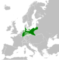
Файл:Kingdom of Prussia 1870.svg

Сығанаҡ файл (SVG файлы, кәмендә 450 × 456 нөктә, файлдың дәүмәле: 705 КБ)
Был файл һаҡлау урыны Викиһаҡлағыста һаҡлана. Уның тураһында мәғлүмәттәр түбәндә күрһәтелгән.
Викиһаҡлағыс — Викимедиа проекттарында ҡулланылған ирекле файлдар өсөн үҙәкләштерелгән һаҡлағыс. |
Ҡыҫҡа аңлатма
Лицензиялау
- Һеҙгә мөмкин:
- бүлешергә – эште күсереп алырға, таратырға һәм тапшырырға
- үҙгәртергә – эште яраҡлаштырырға
- Түбәндәге шарттарҙа:
- авторлыҡты асыҡлау – Авторлыҡты, лицензияға һылтанманы һәм авторҙың ниндәй ҙә булһа үҙгәрештәр индергәнме-юҡмы икәнлеген күрһәтергә тейешһегеҙ. Быны теләһә ниндәй ысул менән эшләргә мөмкин, әммә лицензиат һеҙгә ярҙам иткән йәки ошо әҫәрҙе ҡулланыуығыҙҙы хуплаған тигән тойғо тыуырға тейеш түгел.
- шул уҡ шарттарҙа – Әгәр һеҙ был әҫәрҙе үҙгәртәһегеҙ, уның нигеҙендә яңы әҫәр яҙаһығыҙ икән, сығанаҡ әҫәр рөхсәтнамәһен йәки шуға тура килә торған лицензия ҡулланырға тейешһегеҙ.
Краткие подписи
Элементы, изображённые на этом файле
һүрәтләнгән объект
31 май 2016
Файл тарихы
Файлдың күрһәтелгән ваҡытта ниндәй өлгөлә булғанын ҡарар өсөн баҫығыҙ: Дата/ваҡыт
| Дата/ваҡыт | Миниатюра | Үлсәмдәре | Ҡатнашыусы | Иҫкәрмә | |
|---|---|---|---|---|---|
| ағымдағы | 02:54, 1 июнь 2016 |  | 450 × 456 (705 КБ) | Alphathon | Various corrections to the states of the North German Confederation |
| 05:22, 31 май 2016 |  | 450 × 456 (662 КБ) | Alphathon | Minor corrections (Tarasp and post-1818 German Confederation border change) | |
| 02:40, 31 май 2016 |  | 450 × 456 (662 КБ) | Alphathon | == {{int:filedesc}} == {{Inkscape}} {{Information |Description={{en|A map of the en:Kingdom of Prussia within the North German Confederation and within Europe circa 1870 CE.}} |Source= {{Derived from|Blank_map_of_Europe.svg|display=50}} |Da... |
Файл ҡулланыу
Был файлды ҡулланған биттәр юҡ.
Файлды глобаль ҡулланыу
Был файл түбәндәге википроекттарҙа ҡулланыла:
- af.wiktionary.org проектында ҡулланыу
- ar.wikipedia.org проектында ҡулланыу
- bn.wikipedia.org проектында ҡулланыу
- ckb.wikipedia.org проектында ҡулланыу
- en.wikipedia.org проектында ҡулланыу
- eo.wiktionary.org проектында ҡулланыу
- es.wikipedia.org проектында ҡулланыу
- es.wiktionary.org проектында ҡулланыу
- eu.wikipedia.org проектында ҡулланыу
- fa.wikipedia.org проектында ҡулланыу
- fi.wikipedia.org проектында ҡулланыу
- he.wikipedia.org проектында ҡулланыу
- hu.wikipedia.org проектында ҡулланыу
- is.wikipedia.org проектында ҡулланыу
- it.wikipedia.org проектында ҡулланыу
- li.wiktionary.org проектында ҡулланыу
- lld.wikipedia.org проектында ҡулланыу
- lt.wikipedia.org проектында ҡулланыу
- mn.wikipedia.org проектында ҡулланыу
- pl.wikipedia.org проектында ҡулланыу
- pt.wikipedia.org проектында ҡулланыу
- rue.wikipedia.org проектында ҡулланыу
- ru.wikipedia.org проектында ҡулланыу
- ru.wiktionary.org проектында ҡулланыу
- sk.wikipedia.org проектында ҡулланыу
- szl.wikipedia.org проектында ҡулланыу
- tr.wikipedia.org проектында ҡулланыу
- uk.wikipedia.org проектында ҡулланыу
- uz.wikipedia.org проектында ҡулланыу
- xmf.wikipedia.org проектында ҡулланыу
- zh-yue.wikipedia.org проектында ҡулланыу
- zh.wikipedia.org проектында ҡулланыу
Метамәғлүмәттәр
Файл һанлы камералар йәки сканерҙар өҫтәгән мәғлүмәттәргә эйә. Әгәр файл яһалғандан һуң төҙәтелгән булһа, ҡайһы бер параметрҙар ағымдағы рәсем менән тап килмәҫкә мөмкин.
| Ҡыҫҡа исем | Kingdom of Prussia ca. 1870 |
|---|---|
| Рәсемдең исеме | A map of the Kingdom of Prussia within the North German Confederation and within Europe circa 1870.
Released under CreativeCommons Attribution-ShareAlike 4.0 (CC BY-SA 4.0; https://creativecommons.org/licenses/by-sa/4.0/) by Wikimedia Commons user Alphathon (https://commons.wikimedia.org/wiki/User:Alphathon) The map is based on https://commons.wikimedia.org/wiki/File:Blank_map_of_Europe.svg. The metadata description for that file is contained below: A blank Map of Europe. Every country has an id which is its ISO-3166-1-ALPHA2 code in lower case. Members of the EU have a class="eu", countries in europe (which I found turkey to be but russia not) have a class="europe". Certain countries are further subdivided the United Kingdom has gb-gbn for Great Britain and gb-nir for Northern Ireland. Russia is divided into ru-kgd for the Kaliningrad Oblast and ru-main for the Main body of Russia. There is the additional grouping #xb for the "British Islands" (the UK with its Crown Dependencies - Jersey, Guernsey and the Isle of Man) Contributors. Original Image: (http://commons.wikimedia.org/wiki/Image:Europe_countries.svg) Júlio Reis (http://commons.wikimedia.org/wiki/User:Tintazul). Recolouring and tagging with country codes: Marian "maix" Sigler (http://commons.wikimedia.org/wiki/User:Maix) Improved geographical features: http://commons.wikimedia.org/wiki/User:W!B: Updated to reflect dissolution of Serbia & Montenegro: http://commons.wikimedia.org/wiki/User:Zirland Updated to include British Crown Dependencies as seperate entities and regroup them as "British Islands", with some simplifications to the XML and CSS: James Hardy (http://commons.wikimedia.org/wiki/User:MrWeeble) Validated (http://commons.wikimedia.org/wiki/User:CarolSpears) Changed the country code of Serbia to RS per http://en.wikipedia.org/wiki/Serbian_country_codes and the file http://www.iso.org/iso/iso3166_en_code_lists.txt (http://commons.wikimedia.org/wiki/User:TimothyBourke) Uploaded on behalf of User:Checkit, direct complaints to him plox: 'Moved countries out of the "outlines" group, removed "outlines" style class, remove separate style information for Russia' (http://commons.wikimedia.org/wiki/User:Collard) Updated various coastlines and boarders and added various islands not previously shown (details follow). Added Kosovo and Northern Cyprus as disputed territories. Moved major lakes to their own object and added more. List of updated boarders/coastlines: British Isles (+ added Isle of Wight, Skye, various smaller islands), the Netherlands, Germany, Czech Republic, Denmark, Sweden, Finland, Poland, Kaliningrad Oblast of the Russian Federation (and minor tweaks to Lithuania), Ukraine, Moldova (minor), Romania, Bulgaria, Turkey, Greece, F.Y.R. Macedonia, Serbia, Bosnia and Herzegovina, Montenegro, Albania, Croatia, Italy (mainland and Sicily), Malta (http://commons.wikimedia.org/wiki/User:Alphathon). Added Bornholm (http://commons.wikimedia.org/wiki/User:Heb)Released under CreativeCommons Attribution ShareAlike (http://creativecommons.org/licenses/by-sa/2.5/). |
| Киңлек | 450 |
| Бейеклек | 456 |


